by Rhia Daniel
Orienteering embodies the Open, Green, Public values of your Adelaide Park Lands.
It can be enjoyed as a recreational activity or as a competitive sport.
Orienteering is done by using a map and a compass to find a set number of markings, otherwise known as control points. When done competitively, the idea is to find all control points in the shortest time.


This is usually done on foot, but can also be done using mountain bikes!
To find out more about orienteering in your Adelaide Park Lands, I spoke to Robin Uppill OAM, former President of Orienteering SA and current Technical Officer.
In 2020, Robin Uppill received the Medal of the Order of Australia (General Division) "for service to orienteering".
Robin, how long has Orienteering SA been operating in the Adelaide Park Lands?
“My husband and I established orienteering maps in Belair Air National Park around 20 years ago. The permanent courses in Adelaide Park Lands, like the one Blue Gum Park/Kurangga (Park 20), were created pre-COVID, within the last five years. These maps were re-done and re-uploaded to the Orienteering SA website earlier this year.”
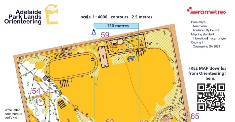
Part of Orienteering SA’s map of Blue Gum Park / Kurangga (Park 20). The course is a permanent one, with 16 orienteering control points fixed in place. See the full map here.
Do you know roughly how any people are orienteering in the Adelaide Park Lands?
“Because the orienteering courses are open and public, there is no way to know for sure how many people are orienteering in the Park Lands. Our maps are downloaded several hundred times a year from the Orienteering SA website, but we’re not sure if people are just having a look, or [actually] using the map [for orienteering].
“Our first Twilight Series Event this year, held in Lefevre Park/Nantu Wama (Park 6) on 17 November, had 90 starting competitors.”
Are there plans to add more orienteering courses in the Adelaide Park Lands?
“Aside from permanent courses, we also have virtual courses. These are run on a phone app called MapRun, which is an augmented reality app. People can load it up on their phone and explore the courses without it disrupting the space or people around them. We’ve got a few of those virtual maps throughout the Adelaide Park Lands, and would love to add more.”
Orienteering SA ran a free orienteering course in Parks 16 and 17 during the Nature Festival in October. How did that go?
“Yes, we ran a series of courses and activities for young children to come and try orienteering. We set up six courses for the children under 7, and we got more than 100 people come out to the event. We would be interested in attending future events, and are already planning for the next year’s Nature Festival.”
If someone were trying orienteering for the first time, what advice would you have for them?
“For their first time orienteering, I would recommend that they come to our Friday night events in the suburbs. These are our Twilight Series events, conveniently situated around the city. It’s a very social atmosphere, not competitive at all.
“Alternatively, I would recommend exploring the permanent courses, as you can complete the course at your own pace and in your own time. They’re free, open and public for anyone to try.”
Banner pic (at the top): Pic: evalinmae.photography, Orienteering SA
Rhia Daniel has moved to Adelaide from Kapunda, and deeply values community and green spaces.


